|
Overview
Where could you undertake fieldwork on flood mitigation strategies, impacts of flood and/or runoff? Local fieldwork There are lots of opportunities to undertake fieldwork at local creeks and rivers. This can be a great opportunity to undertake some small and regular fieldwork close to school grounds, that can be led by the classroom teacher, rather than relying on a full-day fieldwork excursion. This makes it cost effective, relatively easy to organise and engages students in fieldwork on a regular basis. Multi-day Field trip If you are interested in a multi-day field trip to explore flooding in Northern NSW, you may choose to do a trip that follows the river system and incorporates stops at Lismore, Wardell, Woodburn, Coraki, etc. Fieldwork activities Examples of field work activities that could be carried out with a class include: - An examination of runoff in a variety of locations along a river or creek to determine the differences in water quality (turbidity, ammonia, pH, etc) at the different sites, and explore the factors influencing the different sites (e.g. near a storm water drain, near an area with an abundance of vegetation). - A comparison off quality/quantity of run off on impervious surfaces, grass, dense vegetated sites. - Students can compare the field site in person with aerial photographs and maps - identify tributaries, drainage patterns, stormwater outlets, land use that may impact on runoff, infiltration etc. - Students can identify low lying areas at risk of flooding using both observation, flood risk maps and topographic maps - Are there any flood mitigation strategies in place? How is the land used? - students can annotate a map of the local area:
The class should examine local weather conditions, synoptic charts and weather forecasts in the lead up to activities to determine the impact of weather on the day's fieldwork results.
0 Comments
To build conceptual knowledge and understanding and to ensure maximum usability of Powerful Geography content, a conscious effort was made to link content. Each Visualise This, GEOstory and Case study is a stand alone resource but there are connections between them. For example: Studying the Arctic Region in the Content Focus Area: Human - Environment Interactions draws on content from Chapter 2: The Cryosphere and Chapter 3: Forest Systems (Boreal forests) from Earth’s Natural Systems.
The migration of birds from the southern hemisphere to the Arctic in GEOstory 1.1 reinforces the importance of Arctic environments for global biodiversity and Arctic ecosystems. The GEOstory, Churchill, the polar bear capital of the world, looks at challenges facing communities in the Arctic as a result of climate change and the changing behaviour of polar bears. Iceberg Alley describes changes to icebergs along the coast of Newfoundland. Visualise This explain important concepts relevant to the Arctic, many of which link to climate change - glacial and interglacial cycles, ecological succession after glaciers and ice sheets retreat, tipping points, feedback loops and permafrost. Much of the Arctic Ocean is considered ‘high seas’, one of the five recognised global commons that require treaties to govern their sustainable use. Over the coming weeks we will illustrate connections between other Case studies, Visualise This and GEOstories. Some of these connections link to Case studies for Year 12 that will be in Powerful Geograpphy 2. 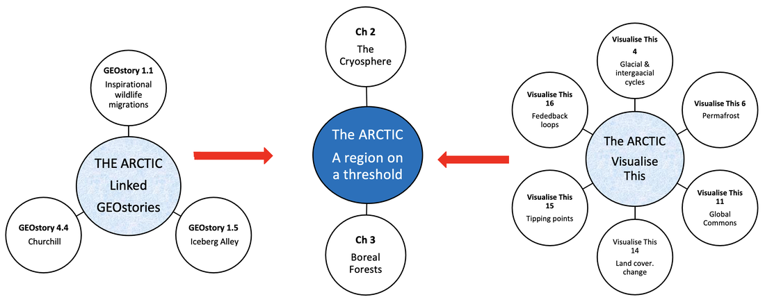 |
AuthorsLorraine Chaffer Categories
All
Archives
June 2024
|
 RSS Feed
